![](/images/other/stat-length.png)
![Trail On foot Sand a.Main - Sander Weintal-Route - Photo](https://media.geolcdn.com/t/1900/400/5d5f8f29-9109-4619-bce0-3623673a4e83.jpeg&format=pjpeg&maxdim=2)
Sander Weintal-Route
SityTrail - itinéraires balisés pédestres
Tous les sentiers balisés d’Europe GUIDE+
![Length](/images/other/stat-length.png)
Length
7.8 km
![Max alt](https://static1.geolcdn.com/siteimages/upload/files/1508320355ic_sort_altitude_max_24dp.png)
Max alt
355 m
![Uphill gradient](https://static1.geolcdn.com/siteimages/upload/files/1508320355ic_sort_den_pos_24dp.png)
Uphill gradient
182 m
![Km-Effort](/images/other/stat-length.png)
Km-Effort
10.2 km
![Min alt](https://static1.geolcdn.com/siteimages/upload/files/1508320355ic_sort_altitude_min_24dp.png)
Min alt
254 m
![Downhill gradient](https://static1.geolcdn.com/siteimages/upload/files/1508320355ic_sort_den_neg_24dp.png)
Downhill gradient
185 m
![Boucle](https://static1.geolcdn.com/siteimages/upload/files/16400158638029165_repeat_loop_refresh_sync_direction_icon.png)
Boucle
Yes
Signpost
Creation date :
2022-02-11 14:34:39.704
Updated on :
2022-02-11 14:34:39.704
![On foot](https://static1.geolcdn.com/sitytour/trail-icons/100.png)
2h19
Difficulty : Easy
![Scan this QR Code to open this trail in the SityTrail application](https://capi.geolives.com/qq0zvz2zws4bq2lad0pu/sitytour/trails/3092842/qr.png?size=200)
FREE GPS app for hiking
About
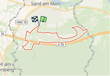
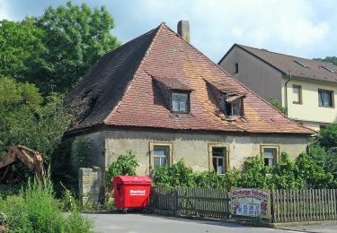
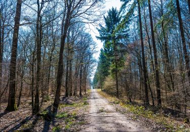
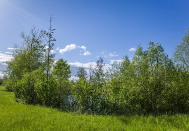
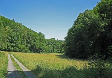
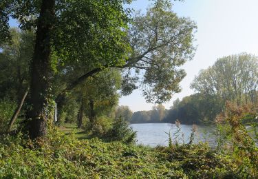
Trail On foot of 7.8 km to be discovered at Bavaria, Landkreis Haßberge, Sand a.Main. This trail is proposed by SityTrail - itinéraires balisés pédestres.
Description
kaum markiert, Verlauf nach aufgestellten Karten
Symbol: Blaue 4 auf weißem Hintergrund
Positioning
Country:
Germany
Region :
Bavaria
Department/Province :
Landkreis Haßberge
Municipality :
Sand a.Main
Location:
Unknown
Start:(Dec)
Start:(UTM)
613599 ; 5537670 (32U) N.
Comments
Trails nearby
![Trail On foot Knetzgau - Rundwanderweg Sand S 5 - Photo](https://media.geolcdn.com/t/375/260/31e55d28-2691-4b8e-b538-95a75c0cd3bf.jpeg&format=jpg&maxdim=2)
![On foot On foot](https://static1.geolcdn.com/sitytour/trail-icons/100.png)
Rundwanderweg Sand S 5
On foot
Easy
Knetzgau,
Bavaria,
Landkreis Haßberge,
Germany
![](/images/other/stat-length.png)
4.5 km | 6.4 km-effort
1h 27min
![](https://static1.geolcdn.com/siteimages/upload/files/16400158638029165_repeat_loop_refresh_sync_direction_icon.png)
Yes
![Trail On foot Haßfurt - Lauftour HAS4 - Photo](https://media.geolcdn.com/t/375/260/076e4c13-279b-43ee-8078-8a52f31d58bb.jpeg&format=jpg&maxdim=2)
![On foot On foot](https://static1.geolcdn.com/sitytour/trail-icons/100.png)
Lauftour HAS4
On foot
Easy
Haßfurt,
Bavaria,
Landkreis Haßberge,
Germany
![](/images/other/stat-length.png)
5.5 km | 5.8 km-effort
1h 18min
![](https://static1.geolcdn.com/siteimages/upload/files/16400158638029165_repeat_loop_refresh_sync_direction_icon.png)
Yes
![Trail On foot Zeil am Main - Rundwanderweg Hase Zeil - Photo](https://media.geolcdn.com/t/375/260/c13b2b94-147c-4957-b7f1-56901bee32f8.jpeg&format=jpg&maxdim=2)
![On foot On foot](https://static1.geolcdn.com/sitytour/trail-icons/100.png)
Rundwanderweg Hase Zeil
On foot
Easy
Zeil am Main,
Bavaria,
Landkreis Haßberge,
Germany
![](/images/other/stat-length.png)
4.3 km | 5.3 km-effort
1h 12min
![](https://static1.geolcdn.com/siteimages/upload/files/16400158638029165_repeat_loop_refresh_sync_direction_icon.png)
No
![Trail On foot Zeil am Main - Lauftour ZEI2 - Photo](https://media.geolcdn.com/t/375/260/fef20e7d-60b5-42f3-ba22-f6d7aa8e228a.jpeg&format=jpg&maxdim=2)
![On foot On foot](https://static1.geolcdn.com/sitytour/trail-icons/100.png)
Lauftour ZEI2
On foot
Medium
Zeil am Main,
Bavaria,
Landkreis Haßberge,
Germany
![](/images/other/stat-length.png)
21 km | 26 km-effort
5h 59min
![](https://static1.geolcdn.com/siteimages/upload/files/16400158638029165_repeat_loop_refresh_sync_direction_icon.png)
Yes
![Trail On foot Zeil am Main - Lauftour ZEI1 - Photo](https://media.geolcdn.com/t/375/260/bfc22e1c-fce2-4dd7-b535-048079984a26.jpeg&format=jpg&maxdim=2)
![On foot On foot](https://static1.geolcdn.com/sitytour/trail-icons/100.png)
Lauftour ZEI1
On foot
Easy
Zeil am Main,
Bavaria,
Landkreis Haßberge,
Germany
![](/images/other/stat-length.png)
12.2 km | 16 km-effort
3h 38min
![](https://static1.geolcdn.com/siteimages/upload/files/16400158638029165_repeat_loop_refresh_sync_direction_icon.png)
Yes
![Trail On foot Zeil am Main - Eichhörnchen-Wanderweg Zeil - Photo](https://media.geolcdn.com/t/375/260/744e9bf0-2eae-4ae5-bf35-2bd1eb7af6ed.jpeg&format=jpg&maxdim=2)
![On foot On foot](https://static1.geolcdn.com/sitytour/trail-icons/100.png)
Eichhörnchen-Wanderweg Zeil
On foot
Easy
Zeil am Main,
Bavaria,
Landkreis Haßberge,
Germany
![](/images/other/stat-length.png)
4.2 km | 5.2 km-effort
1h 11min
![](https://static1.geolcdn.com/siteimages/upload/files/16400158638029165_repeat_loop_refresh_sync_direction_icon.png)
Yes
![Trail On foot Knetzgau - KNE1 - Photo](https://media.geolcdn.com/t/375/260/bcb707e3-1344-40ae-8862-84f3e7fb9e05.jpeg&format=jpg&maxdim=2)
![On foot On foot](https://static1.geolcdn.com/sitytour/trail-icons/100.png)
![Trail On foot Knetzgau - Lauftour KNE3 - Photo](https://media.geolcdn.com/t/375/260/5977babb-b71d-4c24-97dd-ff441d9ab182.jpeg&format=jpg&maxdim=2)
![On foot On foot](https://static1.geolcdn.com/sitytour/trail-icons/100.png)
Lauftour KNE3
On foot
Easy
Knetzgau,
Bavaria,
Landkreis Haßberge,
Germany
![](/images/other/stat-length.png)
9.3 km | 12.6 km-effort
2h 51min
![](https://static1.geolcdn.com/siteimages/upload/files/16400158638029165_repeat_loop_refresh_sync_direction_icon.png)
Yes
![Trail On foot Sand a.Main - Rundwanderweg Sand S1 - Photo](https://media.geolcdn.com/t/375/260/b4817348-57e9-4fe3-a9ec-e32277fad32a.jpeg&format=jpg&maxdim=2)
![On foot On foot](https://static1.geolcdn.com/sitytour/trail-icons/100.png)
Rundwanderweg Sand S1
On foot
Easy
Sand a.Main,
Bavaria,
Landkreis Haßberge,
Germany
![](/images/other/stat-length.png)
3.8 km | 4.2 km-effort
56min
![](https://static1.geolcdn.com/siteimages/upload/files/16400158638029165_repeat_loop_refresh_sync_direction_icon.png)
Yes